Mexico
Mallet, Allain Manesson.
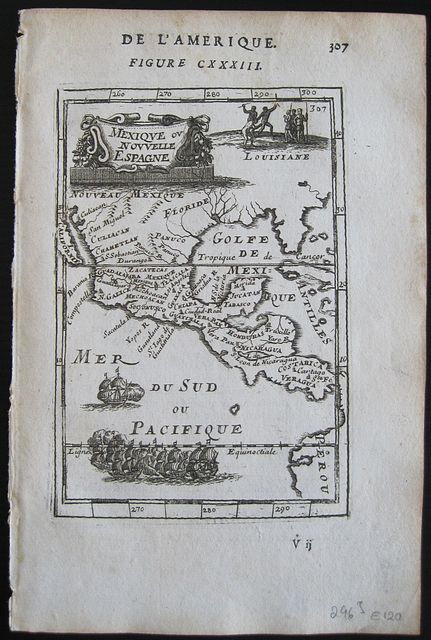
Mexico Mexique ou Nouvelle Espagne. Paris. Thierry. Denys. 1683
Copper engraved map of Mexico and central America from Mallet's "Description de l'Univers" 1st edition. Text to verso.
The map shows Mexico and Central America; with the island of California to the West. New Mexico, Florida, Louisiana, and extending down through Guatamala, Honduras, Nicaragua and Costa Rica, with part of Peru to the South-east.
Strap work cartouche; large fleet of ships to sea and natives dancing within Louisiana. Dark impression; very light toning.
Allain Manesson Mallet 1630- 1706, French cartographer, engineer and mathematician, served in the army of Louis XIV, and also that of the King of Portugal later becoming Inspector of Fortifications to Louis. He published the "Description de l'Univers" in 1683, attempting to describe the cartography, towns, ports, people, habits and traditions of the known world. The work extended to 5 volumes with some 600 illustrations.
His other works were"Les Travaux de Mars, ou L'art de la Guerre" 1684, and "La geometerie Practique" 1702.
150 by 100mm (6 by 4 inches).
ref: 2963
€120